fbpx
Search
Close this search box.
Protecting Northern Michigan's ​Water Resources

Elk River Chain of Lakes Watershed

The Elk River Watershed, covering over 500 square miles, is the largest sub-watershed of Grand Traverse Bay. It is home to the famous Chain of Lakes, 55 miles of connected lakes and streams in Antrim and Kalkaska Counties.

Overview of Elk River Chain of Lakes Watershed

Rivers in the Watershed

Size

321,000 acres

Watershed Management Plan

https://www.watershedcouncil.org/uploads/1/2/6/3/126321286/ercol-final-pdf_10.pdf
The Elk River Watershed, covering over 500 square miles, is the largest sub-watershed of Grand Traverse Bay. It is home to the famous Chain of Lakes, 55 miles of connected lakes and streams in Antrim and Kalkaska Counties. Issues pertaining to the watershed are being addressed under the Grand Traverse Bay Watershed Protection Plan – 2005 (see below), which has been approved by both the Michigan Department of Environmental Quality and the Unites States Environmental Protection Agency. The Watershed Council has partnered with the Watershed Center of Grand Traverse Bay and various local organizations to address these issues, and in November 2010 formed the Elk River Chain of Lakes Watershed Plan Implementation Team (ERCOL WPIT)!
Elk River Chain of Lakes Watershed Plan Implementation Committee (ERCOL WPIT)
The Elk River Chain of Lakes Watershed Plan Implementation Committee (ERCOL WPIT) has a committee webpage with the latest news, lots of cool information, meeting minutes and agendas, and the interactive Fish Shelters map. 

Geographic Description:

LOCATION AND SIZE
The Elk River Chain of Lakes watershed is located in the northwestern region of Michigan’s Lower
Peninsula. It is the largest sub-watershed of the Grand Traverse Bay watershed, covering over 500 square
miles of land and encompassing parts of Antrim, Grand Traverse, Kalkaska, Charlevoix, and Otsego
counties. Within the watershed, Antrim County accounts for the largest land area and largest
number of municipalities within the ERCOL. These towns and villages include Bellaire, Kalkaska, Elk
Rapids, Ellsworth, Central Lake, Mancelona, Rapid City, Alden, Kewadin, Williamsburg, and Atwood.

WATER BODIES
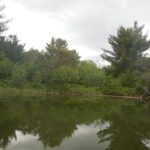
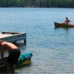
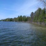
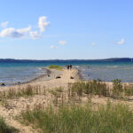
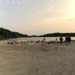
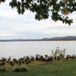
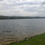
The lakes, rivers, and streams of this watershed provide ample opportunities for recreation, offer stunning
views, support abundant fisheries, and help sustain local economies. The ERCOL watershed contains
nearly 60 square miles of water and over 200 miles of shoreline, and is unique in that it is comprised of 14
interconnected lakes and rivers in Antrim and Kalkaska counties and encompasses over 200 streams, 138
miles of which are designated Blue Ribbon trout streams. Starting at the headwaters near East Jordan, water
flows 55 miles through the chain, drops 40 feet in elevation as it travels into Elk River and finally into
Grand Traverse Bay where it provides approximately 60% of the bay’s tributary flow inputs (Tip of the Mitt
Watershed Council, 2005).
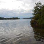
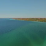
14 lakes make up the Chain of Lakes, however many more lakes can be found within the
watershed including: Mud Lake, Carpenter Lake, Little Torch Lake, Eaton Lake, Thayer Lake, Harwood
Lake, and a number of other small lakes. The Chain of Lakes begins at Beals Lake and flows north into
Scotts Lake. Water then continues north through Six Mile Lake and onto St. Clair Lake. Near the town of
Ellsworth, it turns south through Ellsworth, Wilson, Ben-way, Hanley and Intermediate Lakes. South of the
town of Bellaire, the chain opens into larger bodies of water, flowing south through Lake Bellaire, west
through Clam Lake, and cutting through southern Torch Lake to the Torch River. This main channel then
flows west through Lake Skegemog, north through Elk Lake and out of the Elk River into Lake Michigan.
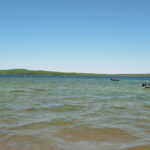
The combined surface area of all fourteen lakes in the chain is 34,420 acres (TOMWC, 2010). The largest
lakes found within the ERCOL are Torch Lake, Elk Lake, and Skegemog Lake. With a maximum
depth of 302 feet, Torch Lake is by far the deepest of all the lakes, followed by Elk Lake with a maximum
depth of 195 feet.
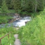
There are seven sub-watersheds within the ERCOL defined by their watershed course.
The largest sub-watershed within the ERCOL is the Rapid River stretching across the southern quadrant
and parts of Kalkaska, Antrim, and Otsego counties. The Rapid River is the longest and fastest
flowing river within the watershed. Following close behind in flow velocity and size are the Grass and
Cedar Rivers. There are many smaller rivers and streams throughout each sub-watershed of the Chain.
Barker Creek, Battle Creek, and Williamsburg Creek are located in the southwestern Elk River subwatershed. Eastport Creek and Wilkinson Creek are on the north side of Torch Lake while Spencer Creek
connects with Torch Lake on its southwestern side. River managers and residents describe several of the
streams on the north side of Torch Lake as flashy and occasionally causing floods in developed areas such
as Eastport and upper Torch Lake. Many more small streams are concentrated in the Hanley Lake Outlet
sub-watershed located, including Ogletree Creek, King Creek, Toad Creek, and Skinner Creek.

TOPOLOGY
Elevations ranges from 535 feet above sea level to 1,561 feet above sea level throughout the watershed. The
highest elevations can be found in the easternmost part of the ERCOL watershed at the border of Antrim
and Otsego Counties. Lower elevations occur toward the west near Lake Michigan and in the north toward
Charlevoix County, with the lowest of elevations surrounding the lower chain lakes such: Torch Lake, Elk
Lake, Lake Bellaire, and Lake Skegemog.

During the summers of 2016 and 2017, the Tip of the Mitt Watershed Council led a coordinated effort to conduct a shoreline survey for 15 Lakes in the Elk River Chain of Lakes Watershed. The surveys were meant to document conditions that could impact water quality, including the three biggest threats to inland lakes: nutrient pollution, habitat loss, and shoreline erosion. Within the Watershed, shoreline properties have a large connection to the surrounding landscape and can serve as the last line of defense for protecting water quality. Conducted on a parcel by parcel basis, survey results indicate that human activity along sections of shoreline of many Lakes is likely impacting the lake water quality to some extent. Importantly, Lake water quality remains quite high in all Lakes surveyed. The purpose of each survey was meant to identify areas of the shoreline that can be enhanced and improved to prevent nutrient pollution, erosion, increase fish habitat, and help protect and conserve the Elk River Chain of Lakes for future generations. Improving areas with poor greenbelts will help the character and quality of your Lake by helping to reduce nutrient pollution and sediment input from erosion along the shoreline. Please visit the Michigan Shoreland Stewards (http://www.mishorelandstewards.org/) for more information on healthy lake practices along the shoreline.

Below are individual Lake reports for all lakes surveyed, highlighting greenbelt status, areas of erosion, and the presence of a bioindicator algae, known as “Cladophora“. Clicking a lake name will open the respective report in a new browser window. Please scroll beneath the lake list for a map depicting survey results. A legend for each map layer is shown by clicking the arrow next to the checked layer. Scroll down for information on greenbelts, Cladophora, and erosion from the survey. For individual parcel results, please contact Tip of the Mitt Watershed Council at (231)347-1181.

Insert 2016/17 Elk River Chain of Lakes Shoreline Survey GIS Map

Picture
Grand Traverse Bay Watershed Protection Plan (2005)
The intent of the protection plan is to assist area watershed groups, lake associations, local governments, volunteer groups, and many others in making sound decisions to help improve and protect water quality in their area. It provides recommendations on how to reduce water quality degradation and protect our valuable resource, the Grand Traverse Bay watershed. 
Picture
Elk River Chain of Lakes Watershed Property Owner’s Permit Guide
If you have plans to build, drill or fill there are some things you should know before you begin. Many home improvement activities are regulated by local, state or federal agencies. As a result, a review process and permits are often required before work begins. This process can be confusing for the homeowner seeking answers. To help you navigate through the right channels, we offer this resource to set you on your course toward achieving your property goals.
Picture
Elk River Chain of Lakes – 2010 Lake Profile
Tip of the Mitt Watershed Council has worked for decades to ensure that our waters remain magnificent resources. The information and data contained in the Chain of Lakes Profile illustrates the hard work of our staff and volunteers to ensure the high water quality of lakes in our region now and in the future.

Additional Publications:

TitleCategoriesLinkhf:doc_categories
Comprehensive Water Quality Monitoring (CWQM)Bass Lake, Beals Lake, Bear River, Ben-Way Lake, Birch Lake, Black Lake, Black Lake Watershed, Black River, Boyne River, Burt Lake, Burt Lake Watershed, Carp River Watershed, Cheboygan River, Cheboygan River Watershed, Clam Lake, Crooked Lake, Crooked River, Deer Lake, Douglas Lake, Duncan-Grass Bay Watershed, Elk Lake, Elk River, Elk River Chain Of Lakes, Elk River Chain of Lakes Watershed, Ellsworth Lake, Grand Traverse Bay Watershed, Hanley Lake, Huffman Lake, Intermediate Lake, Lake Bellaire, Lake Charlevoix, Lake Charlevoix Watershed, Lancaster Lake, Larks Lake, Little Traverse Bay Watershed, Long Lake, Marion Lake, Mud Lake, Mullett Lake, Mullett Lake Watershed, Munro Lake, Nowland Lake, Paradise Lake, Pickerel-Crooked Lakes Watershed, Round Lake, Scotts Lake, Silver Lake, Six Mile Lake, Skegemog Lake, Spring Lake, St. Clair Lake, Susan Lake, Thayer Lake, Thumb Lake, Torch Lake, Twin Lake, Walloon Lake, Walloon Lake Watershed, Wildwood Lake, Wilson Lakebass-lake beals-lake bear-river ben-way-lake birch-lake black-lake black-lake-watershed black-river boyne-river burt burt-lake-watershed carp-river-watershed cheboygan-river-rivers-streams cheboygan-river-watershed clam-lake crooked-lake crooked-river deer-lake douglas-lake duncan-grass-bay-watershed elk-lake elk-river elk-river-chain-of-lakes elk-river-chain-of-lakes-watershed ellsworth-lake grand-traverse-bay-watershed hanley-lake huffman-lake intermediate-lake lake-bellaire lake-charlevoix lake-charlevoix-watershed lancaster-lake larks-lake little-traverse-bay-watershed long-lake marion-lake mud-lake mullett-lake mullett-lake-watershed munro-lake nowland-lake paradise-lake pickerel-crooked-lakes-watershed round-lake scotts-lake silver-lake six-mile-lake skegemog-lake spring-lake st-clair-lake susan-lake thayer-lake thumb-lake torch-lake twin-lake walloon-lake walloon-lake-watershed wildwood-lake wilson-lake inland-lakes rivers-streams watersheds
2017 Torch Lake Shoreline SurveyElk River Chain Of Lakes, Shoreline Surveys, Torch Lakeelk-river-chain-of-lakes shoreline-surveys torch-lake inland-lakes
2017 Thayer Lake Shoreline SurveyElk River Chain Of Lakes, Shoreline Surveys, Thayer Lakeelk-river-chain-of-lakes shoreline-surveys thayer-lake inland-lakes
2017 Skegemog Lake Shoreline SurveyElk River Chain Of Lakes, Shoreline Surveys, Skegemog Lakeelk-river-chain-of-lakes shoreline-surveys skegemog-lake inland-lakes
2017 Lake Bellaire Shoreline SurveyElk River Chain Of Lakes, Lake Bellaire, Shoreline Surveyselk-river-chain-of-lakes lake-bellaire shoreline-surveys inland-lakes
2017 Elk Lake Shoreline SurveyElk Lake, Elk River Chain Of Lakes, Shoreline Surveyselk-lake elk-river-chain-of-lakes shoreline-surveys inland-lakes
2017 Clam Lake Shoreline SurveyClam Lake, Elk River Chain Of Lakes, Shoreline Surveysclam-lake elk-river-chain-of-lakes shoreline-surveys inland-lakes
2016 Wilson Lake Shoreline SurveyElk River Chain Of Lakes, Shoreline Surveys, Wilson Lakeelk-river-chain-of-lakes shoreline-surveys wilson-lake inland-lakes
2016 St. Clair Lake Shoreline SurveyElk River Chain Of Lakes, Shoreline Surveys, St. Clair Lakeelk-river-chain-of-lakes shoreline-surveys st-clair-lake inland-lakes
2016 Six Mile Lake Shoreline SurveyElk River Chain Of Lakes, Shoreline Surveys, Six Mile Lakeelk-river-chain-of-lakes shoreline-surveys six-mile-lake inland-lakes
2016 Intermediate Lake Shoreline SurveyElk River Chain Of Lakes, Intermediate Lake, Shoreline Surveyselk-river-chain-of-lakes intermediate-lake shoreline-surveys inland-lakes
2016 Hanley Lake Shoreline SurveyElk River Chain Of Lakes, Hanley Lake, Shoreline Surveyselk-river-chain-of-lakes hanley-lake shoreline-surveys inland-lakes
2016 Ellsworth Lake Shoreline SurveyElk River Chain Of Lakes, Ellsworth Lake, Shoreline Surveyselk-river-chain-of-lakes ellsworth-lake shoreline-surveys inland-lakes
2016 Ben Way Lake Shoreline SurveyBen-Way Lake, Elk River Chain Of Lakes, Shoreline Surveysben-way-lake elk-river-chain-of-lakes shoreline-surveys inland-lakes
2016 Beals and Scotts Lake Shoreline SurveyBeals Lake, Elk River Chain Of Lakes, Scotts Lake, Shoreline Surveysbeals-lake elk-river-chain-of-lakes scotts-lake shoreline-surveys inland-lakes
2010 Elk River Chain of Lakes Profile CWQMBen-Way Lake, Clam Lake, Comprehensive Water Quality Monitoring, Elk Lake, Elk River Chain Of Lakes, Elk River Chain of Lakes Watershed, Ellsworth Lake, Hanley Lake, Intermediate Lake, Six Mile Lake, Skegemog Lake, St. Clair Lake, Torch Lake, Wilson Lakeben-way-lake clam-lake comprehensive-water-quality-monitoring elk-lake elk-river-chain-of-lakes elk-river-chain-of-lakes-watershed ellsworth-lake hanley-lake intermediate-lake six-mile-lake skegemog-lake st-clair-lake torch-lake wilson-lake inland-lakes watersheds