Description:
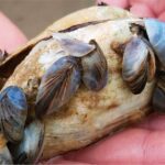
Wilson Lake is located in the upper Elk River Chain of Lakes. A short section (1/4 mile) of the Intermediate River feeds Wilson Lake from Ellsworth Lake; another short section (1/3 mile) flows from Wilson Lake into Ben-Way Lake. Von Stratten Creek is a small inlet in the southwest corner of the lake. A pronounced sand delta is evident at this creek’s mouth, a result of the sand bedload carried by the creek. The lake supports populations of largemouth bass, bluegill and longnose gar, among other species.
Monitoring and Research:
Wilson Lake is monitored every three years through the Watershed Council’s Comprehensive Water Quality Monitoring (CWQM) Program for dissolved oxygen, specific conductivity, pH, nitrate-nitrogen, total nitrogen, total phosphorus, and chloride levels.
It is NOT monitored through the Watershed Council’s Volunteer Lake Monitoring (VLM) Program. If you are interested in becoming a volunteer, contact the Watershed Council at 231-347-1181.
The Elk River Chain of Lakes Watershed Plan Implementation Team meets regularly and is working to protect the lakes in the Chain.
Additional Resources:
See additional resources on our Aquavist page.
A wide variety of maps for this area are available online at the Michigan Natural Features Inventory (MNFI) Data Resources page.
Shoreline Survey:
Elk River Chain of Lakes Shoreline Survey
Project Summary During the summers of 2016 and 2017, the Tip of the Mitt Watershed Council led a coordinated effort to conduct a shoreline survey for 15 Lakes in the Elk River Chain of Lakes Watershed. The surveys were meant to document conditions that could impact water quality, including the