A watershed management plan identifies problems and threats to water resources and develops a framework to address these issues within a specific watershed.
The primary purpose of a watershed management plan is to guide watershed coordinators, resource managers, policy makers, and community organizations to restore and protect the quality of lakes, rivers, streams, and wetlands in a given watershed. The plan is intended to be a practical tool with specific recommendations on practices to improve and sustain water quality. As part of the development of a watershed management plan, resource inventories are conducted to assess many different types of nonpoint source pollutions. Inventories that are typically conducted are agriculture, forestry, road stream crossings, streambank and shoreline surveys. In order to be eligible for 319 nonpoint source funding, these management plans have to meet EGLE’s Clean Michigan Initiative (CMI) criteria and EPA’s 9 Elements of a Watershed Management Plan.
The Watershed Council has been a key party involved with the development of watershed management plans for all major watersheds as well as several sub-watersheds in our service area. These are “living documents,” meaning that as conditions change over time in a watershed, the plan must be reexamined and revised to reflect goals that have been achieved or not met.
Shoreline Surveys
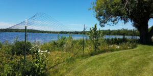
Burt Lake Watershed Greenbelt Cost Share Project
An opportunity for financial and technical support to property owners on Burt, Douglas, Crooked, and Pickerel Lakes for voluntary shoreline greenbelt improvement and restoration projects.
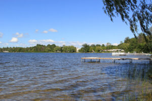
Bass Lake Shoreline Survey 2022
Project Summary Bass Lake is located on the northern side of the Village of Elk Rapids, between Elk
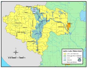
Larks Lake Shoreline Survey 2022
Project Summary Larks Lake is a small inland lake, covering 600 acres, located in northern Emmet County. Larks
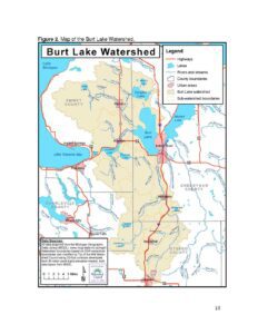
Burt Lake Shoreline Survey 2022
Project Summary The Burt Lake Watershed lies in the very center of Northern Michigan and sprawls over nearly
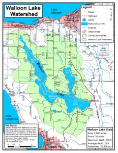
Walloon Lake Shoreline Survey 2020
Project Summary During the summer of 2020, Tip of the Mitt Watershed Council conducted a shoreline survey on
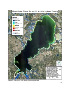
Mullett Lake Shoreline Survey 2016
Project Summary During the summer of 2016, the Tip of the Mitt Watershed Council conducted a shoreline survey
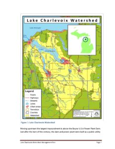
Lake Charlevoix Shoreline Survey 2018
Project Summary During the summer and fall of 2018, Lake Charlevoix Association partnered with Tip of the Mitt
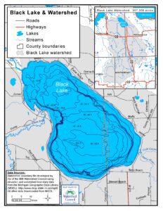
Black Lake Shoreline Survey 2017
Project Summary During the summer of 2017, the Black Lake Association (BLA) contracted with Tip of the Mitt
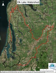
Elk River Chain of Lakes Shoreline Survey
Project Summary During the summers of 2016 and 2017, the Tip of the Mitt Watershed Council led a
Document Resources
| Title | Link |
|---|---|
| 2024 Mullett Lake, Lower Black/Cheboygan Rivers Watershed Management Plan | |
| 2022 Larks Lake Watershed Management Plan | |
| 2022 Elk River Chain of Lakes Watershed Management Plan | |
| 2021 Coastal Grand Traverse Bay Watershed Plan | |
| 2018 Burt Lake Watershed Management Plan | |
| 2016 Duncan and Grass Bays Watershed Management Plan | |
| 2012 Lake Charlevoix Watershed Management Plan | |
| 2007 Little Traverse Bay Watershed Management Plan |
EGLE/EPA approved watershed management plans:
Burt Lake Watershed Management Plan
Duncan-Grass Bays Watershed Management Plan
Elk River Chain of Lakes Watershed Management Plan (in-progress)
Lake Charlevoix Watershed Management Plan
Little Traverse Bay Watershed Protection Plan
Mullett Lake Watershed Management Plan (in-progress)
Other Plans:
Black Lake Watershed Stewardship Initiative
Cheboygan River Watershed Habitat Partnership Conservations Area Plan
Grand Traverse Bay Watershed Management Protection Plan
Larks Lake Watershed Plan
Lower Black River Watershed Management Initiative
Mullett Creek Watershed Management Plan
Paradise Lake Management Plan
Pickerel-Crooked Lakes Nonpoint Source Pollution Management Plan
Stover Creek Restoration and Management Plan
Tannery Creek Watershed Management Plan

