The Cheboygan River Watershed was identified in 1996 as a key aquatic biodiversity site in the Great Lakes Ecoregion during an intensive ecoregional planning process conducted by an inter-organizational group of experts (The Nature Conservancy, 2000).
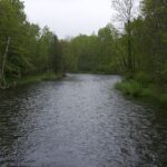
click to view larger imageThe Cheboygan River Watershed – long recognized by local residents and conservation groups for its natural resource values – was identified in 1996 as a key aquatic biodiversity site in the Great Lakes Ecoregion during an intensive ecoregional planning process conducted by an inter-organizational group of experts (The Nature Conservancy, 2000). This process of ecoregional planning was initiated by the Great Lakes Program of The Nature Conservancy (TNC) to identify high priority biodiversity conservation areas that represent the full range of biodiversity across the ecoregion, including common and rare species, communities, and other significant natural features. The Cheboygan River Watershed supports high-quality examples of aquatic and terrestrial biodiversity that, in conjunction with other identified sites in the Great Lakes Ecoregion, contribute to this objective of comprehensive biodiversity conservation.
In addition to large kettle lakes, large forested areas, and an expansive network of streams and wetlands, this 900,000-acre Watershed is home to a variety of aquatic species including several that are endangered, the Michigan monkey-flower (Mimulus glabratus var. michiganensis), Hungerford’s crawling water beetle (Brychius hungerfordi), and the state threatened lake sturgeon (Acipenser fulvescens). Several large wetlands, such as the Indian River Spreads and the Pigeon River Spreads, also provide important nesting habitat for rare birds such as the bald eagle (Haliaeetus leucocephalus), the common loon (Gavia immer) and the black tern (Chlidonias niger).
To Read More About the Cheboygan River Watershed, Follow the Story Map Below
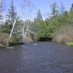
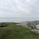
The Cheboygan River drains parts of Emmet, Cheboygan, Presque Isle, Charlevoix, Otsego, and Montmorency Counties at the northern tip of Michigan’s Lower Peninsula. The Cheboygan River itself is a short reach between Mullett Lake and the Straits of Mackinac, where the Cheboygan empties into Lake Huron. The drainage area of the Cheboygan River includes over 900,000 acres and numerous rivers and lakes. In addition to Mullett Lake, other large lakes include Douglas Lake, Burt Lake, Pickerel Lake, Crooked Lake, and Black Lake. The major rivers in the Cheboygan River drainage basin include the Crooked River, Maple River, Sturgeon River, Pigeon River, and Black River. Several of these systems are connected in what is called the Inland Waterway.
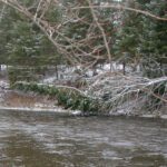
Numerous glacial retreats and advances define the irregular topography of this Watershed. The current landscape is a direct product of this ice scouring and redeposition, as well as postglacial erosion and soil formation processes. The resulting landscape is characterized by steep morainal ridges, rolling drumlins, kettle lakes, swamps, marshes, and depressions (Albert 1995).