Description:
This gives us even more reason to protect this remarkable natural treasure. Sedimentation and nutrient pollution from the activities in the watershed could have the opportunity to negatively impact the creek and its water quality. By using Best Management Practices (BMP’s) and sensible riverbank development, it is up to all of us to protect the health of this amazing creek.
Other Threats to Water Quality
- Nonpoint Source Pollution
- Eroding riverbanks
- Agriculture
Monitoring
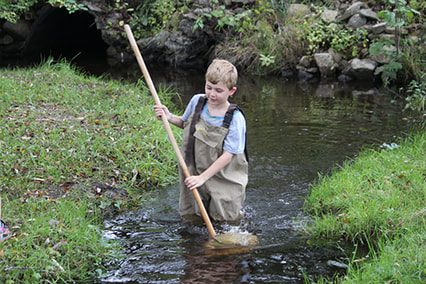
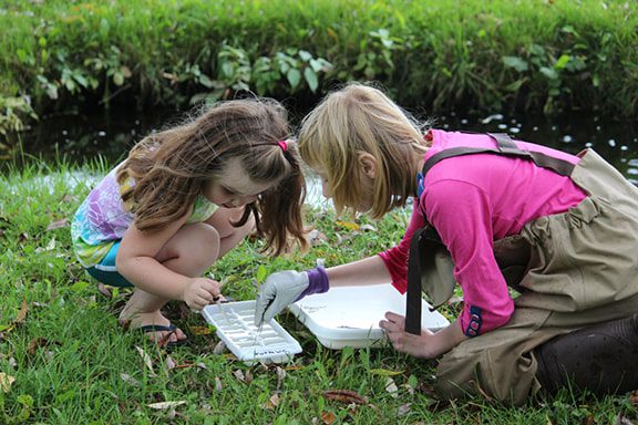
Biological monitoring is performed by volunteers in Kimberly Creek each spring and fall as part of the Watershed Council’s Volunteer Stream Monitoring (VSM) Program.
Additional Resources:
Information about Threatened, Endangered, and Special Concern species in this stream’s watershed is available on the Michigan Natural Features Inventory (MNFI) website.
Discharge data for this stream is available online through the Michigan Department of Environmental Quality’s Low Flow Discharge Data Base.
USGS Current Water Data for Michigan provides stream flow conditions.
A wide variety of maps, including Vegetation circa 1800, National Wetlands Inventory, Land Cover Change 1800’s to 1978, Wetland Change 1800’s to 1980, and many other resources for this area are available online in the Michigan Natural Features Inventory (MNFI) Data Resources page.
Learn about safely eating fish from this river in the Michigan Fish Consumption Advisory.
| Title | Link |
|---|