fbpx
Protecting Northern Michigan's ​Water Resources

Douglas Lake Shoreline Survey 2024

Project Summary

In the spring of 2024, Tip of the Mitt Watershed Council (hereafter referred to as the Watershed Council) contracted with Douglas Lake Improvement Association (hereafter referred to as DLIA) to conduct a shoreline survey on Douglas Lake in the summer of 2024. This shoreline survey project is also funded in part by the Michigan Department of Environment, Great Lakes, and Energy’s (EGLE) Nonpoint Source Program by the United States Environmental Protection Agency. In 2021, the Watershed Council acquired funding from EGLE to address poor shoreline management and weak water resource protection ordinances within the Burt Lake Watershed. Thus, through funding generously provided by
DLIA and EGLE, the shoreline of Douglas Lake was fully surveyed and assessed for algal growth and density, erosion severity, degree of parcel development, shoreline alterations, and greenbelt status. Documenting this data, on an individual parcel status, expedites the understanding of inland lake shoreline conditions and their subsequent impact on water quality. The invaluable lake data generated via the shoreline survey can be used to assess long-term trends in shoreline health and protect and maintain the high-quality waters of Douglas Lake.

For the full 2024 Douglas Lake Shoreline Survey Report, click here.

Welcome to the 2024 Douglas Lake Shoreline Survey Web App

How to use this tool: After closing this splash screen, type your Unique ID into the query box on the left side of the screen. Your individual property scores will populate in the same box. Below the query box, you can view the map legend and select the layers you want to view on the map for results around the lake. On the right side of the screen, you can view graphics for each category summarizing results from around the lake.

This project was completed with funds from Douglas Lake Improvement Association and the Michigan Department of Environment, Great Lakes, and Energy’s Nonpoint Source Pollution (EGLE 319) Grant Program.

The purpose of the Douglas Lake Improvement Association is to preserve, protect and improve the quality of Douglas Lake and its environs and the quality of life of its residential community. Learn more.

Greenbelts

Greenbelts are a natural buffer of native vegetation between the water’s edge and your lawn that helps to reduce erosion by stabilizing the soil, filtering nutrients and other pollution. Greenbelts can also deter geese who prefer well-manicured lawns and unrestricted access to the water.

Greenbelt Scores

Greenbelts, i.e. strips of native vegetation, were characterized based on the length of shoreline they occupied, and the depth (in feet) that they extended from the shoreline landward into the parcel. Ratings for length ranged from zero to four while depth ranged from zero to three. Overall scores were based on the following categorizations:
 

Table 8. Greenbelt Scoring Chart.

Score

Length (%)

Depth (feet)

0

Absent

Absent

1

<10%

<10

2

10-25%

10-40

3

25-75%

>40

4

>75%

N/A

Greenbelt ratings for the length and depth of the vegetation were summed to produce an overall score describing the status, or health, of the greenbelt. Scores of 0 were considered very poor, 1-2: poor, 3-4: moderate, 5-6: good, and 7: excellent.

Erosion Severity

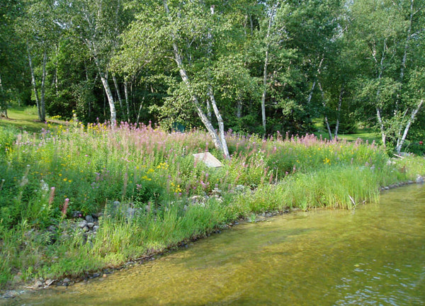
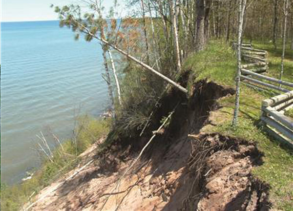
Erosion introduces sediments and excess nutrients attached to soil particles. An abnormal increase in sediments can clog the gills of fish, macroinvertebrates, and degrade habitat including fish spawning grounds. Increased nutrients can cause algal blooms that degrade lake water quality.

Picture


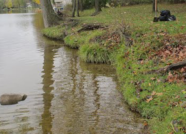
L = Exposed soils, gullies up to 1″ deep.

Picture

 
M = Exposed soils, gullies greater than 1″ but less than 6″ deep, and/or banks undercut by 6″ (minor slumping)

Picture

 
H = Exposed soils, gullies greater than 6″ deep, and/or banks undercut by more than 6″ (severe slumping)

Cladophora Density

Cladophora is an algae that grows as a film and in later growth stages as filaments on hard substrate near the shoreline. Increased nutrients, such as phosphorus from failing septic systems, enhance Cladophora growth to abnormal levels. Monitoring Cladophora serves as a useful bio-indicator of changes to nutrient inputs near the shoreline.
 

To improve your stewardship, visit the Michigan Shoreland Stewards (MiSS) website. ​The MiSS program provides recognition for lakefront property owners who are protecting inland lakes through best management practices on their property and provides recommendations for improving your shoreline